
ShekouDaily | September 12, 2017
We’ll continue to update this page with information regarding TALIM’s effect on Shenzhen.
You may need to “refresh” the page when you return to see the new information.
UPDATE: 4:20pm. Another Tropical Storm has formed in the South China Sea and is expected to become a Typhoon before making landfall on Friday. See “Double Typhoon Trouble for China this Week“.
———
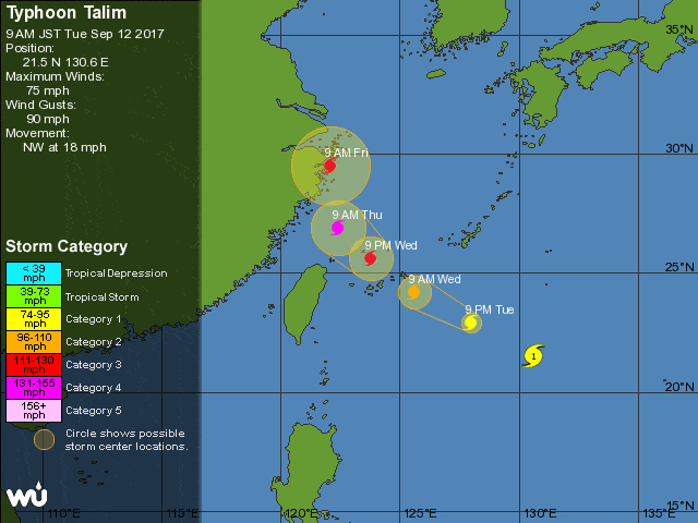
UPDATE: Around 10:30am Tuesday, the Weather Underground released an updated trajectory for 8am CST forecasting Category 4 scale winds between 131-155 mph (211-250 km/h). The HKO announced that as of 8am, Talim is expected to move across the western North Pacific and intensify gradually in the next couple of days, moving in the generally direction of the vicinity of Zhejiang afterwards.
———
Track the storm in real-time:
———
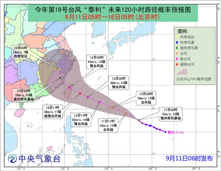
On September 11th, the China Meteorological Administration (CMA) announced that early morning yesterday, typhoon Talim evolved into a severe tropical storm. They forecasted that Typhoon Talim was expected to move northwestward at a speed of 25~30 km/h with a gradually strengthening force. The announcement projected landfall on the eastern Taiwan coast on September 13 as a severe typhoon, or possibly a super typhoon, scale 15~16, with 48~55 m/s (107-123 mph or 173-198 km/h) before moving toward the Zhejiang and Fujian coasts.
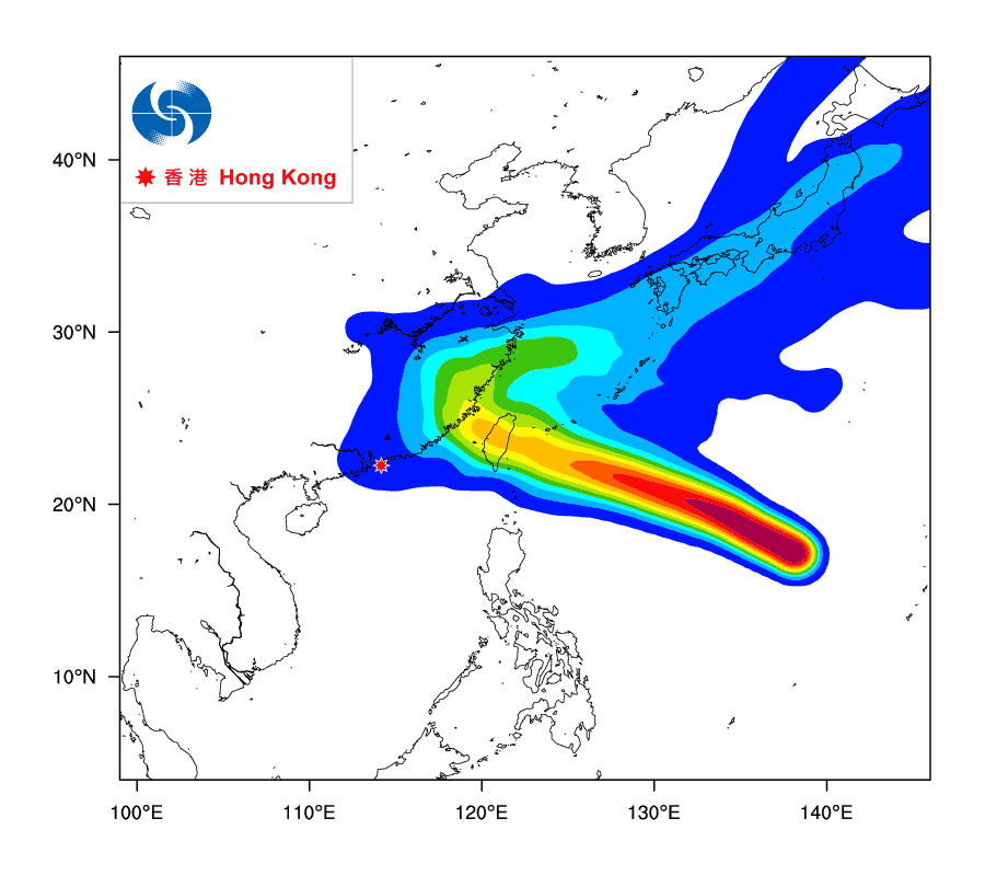
The Hong Kong Observatory (HKO) reported Monday that Talim will move across the western North Pacific towards the vicinity of Taiwan and intensify gradually into a super typhoon within the next couple of days, with maximum sustained winds at its center of 185 km/h (or 115 mph). According to the HKO’s Tropical Cyclone Track Probability Index (BETA), as of September 11th, there was less than a 10% chance that Talim will pass over Hong Kong; however, the subsiding air will bring hot temperatures to Hong Kong during the latter part of the week.
Chief Engineer at Fujian’s meteorological bureau told the South China Morning Post yesterday, as they prepare to evacuate up to half a million people, that “Talim is a giant. It will dwarf any of the others [typhoons] we’ve seen this year.” She added that by the time TALIM makes landfall it would most likely have grown into a super typhoon, the highest level in China’s rating system and comparable to a category 4 or 5 hurricane in the United States.
The Weather Underground’s forecasted trajectory as of 2am this morning showed Talim reaching Category 3 Hurricane strength (with wind speeds between 111-130 mph or 179-209 km/h) Wednesday afternoon before hitting the northern part of Taiwan.
This morning, the Japan Meteorological Agency forecasted the strongest wind gusts, with speeds as high as 70 m/s (156 mph or 252 km/h), on Wednesday September 13th as TALIM approaches the northern part of Taiwan.
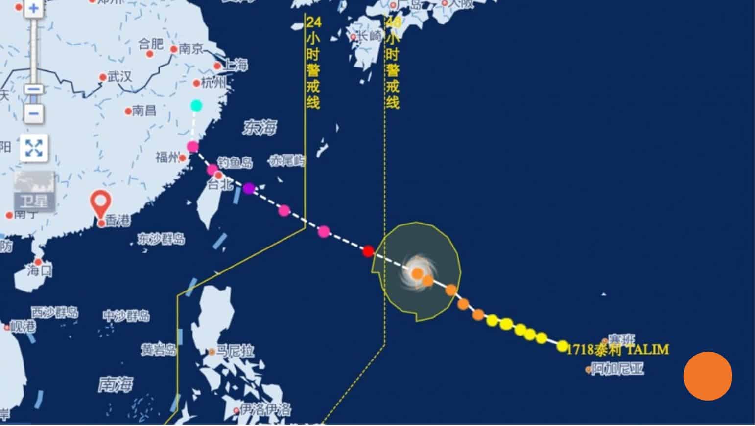
Talim will very likely come within 800km of Hong Kong on Thursday, which could trigger storm signal No 1. It is too early to tell if the No 8 signal will be hoisted, an observatory spokesman said. As of 8am Tuesday Morning, neither the HKO nor the Shenzhen Meteorological Bureau (SZMB) had issued any Typhoon warnings ahead of Talim.
We’ll continue to update this page with information regarding TALIM’s effect on Shenzhen.
You may need to “refresh” the page when you return to see the new information.