ShekouDaily | October 31, 2018
UPDATE: By 1 p.m., November 2nd, all Typhoon warnings had been cancelled. This page will no longer be updated.
UPDATE: At 7:25 a.m November 2nd, the SZMB downgraded their Typhoon Warning to White for the entire city. At 8:10 a.m, the HKO cancelled all their warnings.
We’ll update this page with more information as it becomes available. In the meantime, you can also use the Storm Trackers and Windy APP below to keep an eye on the storm.
UPDATE from the HKO at 4:45 p.m:
According to the present forecast track, Yutu will continue to edge closer to the coastal waters of eastern Guangdong today. Strong to gale force winds are affecting that area. The Strong Wind Signal, No. 3 is expected to remain in force for a period of time.
Under the influence of the northeast monsoon, Yutu will become slow-moving and gradually weaken tomorrow.
As there are swells, you are advised to stay away from the shoreline and not to engage in water sports.
UPDATE: The HKO Issued their Strong Wind Signal, No. 3 at 12:45 p.m., today.
This means that winds with mean speeds of 41 to 62 kilometres per hour are expected.
At 1 p.m., Severe Tropical Storm Yutu was estimated to be about 360 kilometres southeast of Hong Kong (near 19.9 degrees north 116.5 degrees east) and is forecast to move north or north-northwest at about 12 kilometres per hour crossing the northeastern part of the South China Sea.
According to the present forecast track, Yutu will continue to edge closer to the coastal waters of eastern Guangdong today. With the combined effect of the northeast monsoon and Yutu, winds over the coast of eastern Guangdong are expected to strengthen gradually this afternoon and tonight.
Unless Yutu takes on a track closer to the Pearl River Delta, the chance of issuing the No. 8 Gale or Storm Signal is not high.
As there are swells, you are advised to stay away from the shoreline and not to engage in water sports.
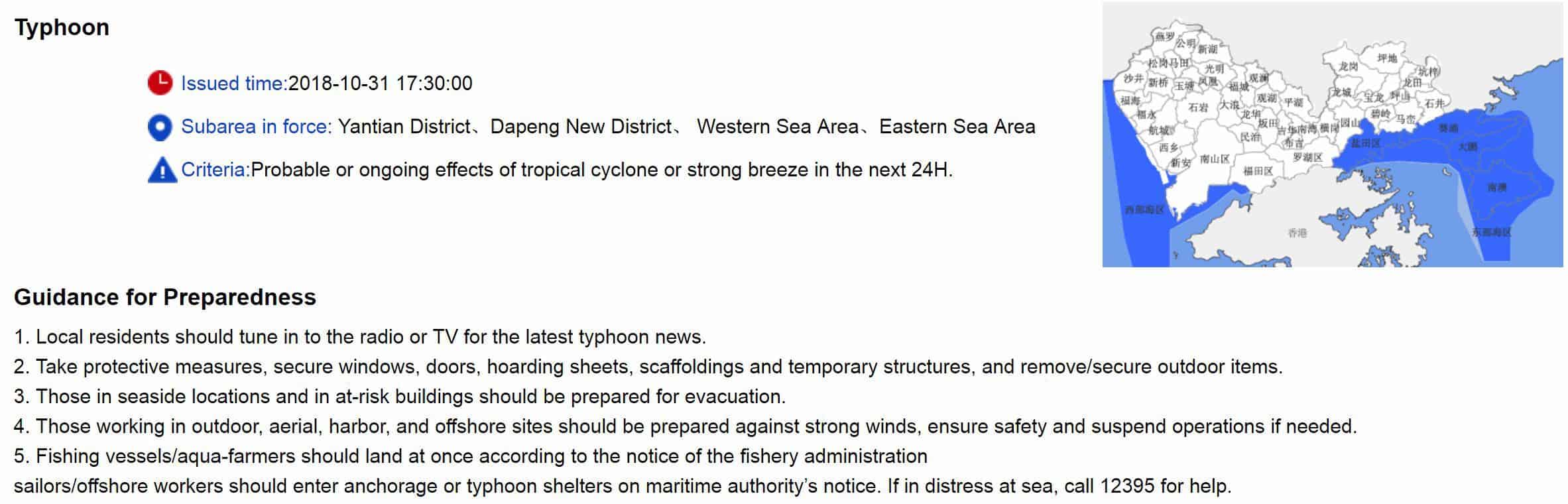
HKO’s Precautionary Announcements with No. 3 Signal
1. Precautions should be taken. Make sure objects likely to be blown away are securely fastened or taken indoors.
2. Construction and property management practitioners should make sure that overhanging facilities and temporary structures outdoors are securely fastened or placed on the ground, and complete precautionary measures as soon as possible.
3. Small vessel owners should now complete all safety arrangements and return to nearby typhoon shelters.
4. Listen to radio, watch TV or browse the Hong Kong Observatory’s website and mobile app for the latest information on the tropical cyclone
UPDATE from the HKO at 11:45 a.m:
In the past few hours, Yutu continued to edge closer to the coastal waters of eastern Guangdong. With the combined effect of the northeast monsoon and Yutu, winds over the coast of Guangdong are expected to strengthen gradually this afternoon. The Observatory will issue the Strong Wind Signal, No. 3 shortly.
Unless Yutu takes on a track closer to the Pearl River Delta, the chance of issuing the No. 8 Gale or Storm Signal is not high.
UPDATE from the HKO at 8:45 a.m:
According to the present forecast track, Yutu will continue to edge closer to the coastal waters of eastern Guangdong today. With the combined effect of the northeast monsoon and Yutu, winds over the coast of Guangdong are expected to strengthen gradually this afternoon. The Observatory will consider issuing the Strong Wind Signal, No. 3 between noon and 2 p.m.
As there are swells, you are advised to stay away from the shoreline and not to engage in water sports.
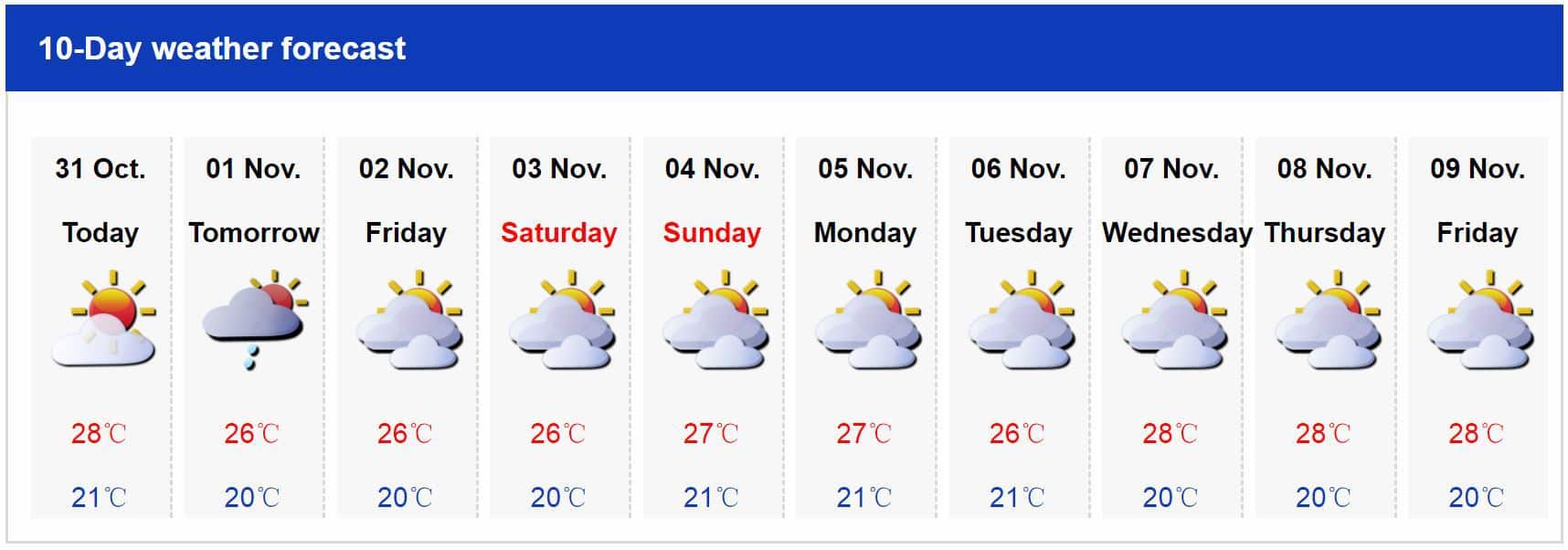
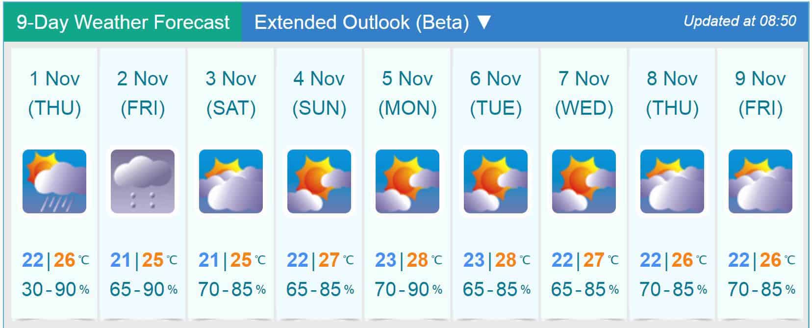
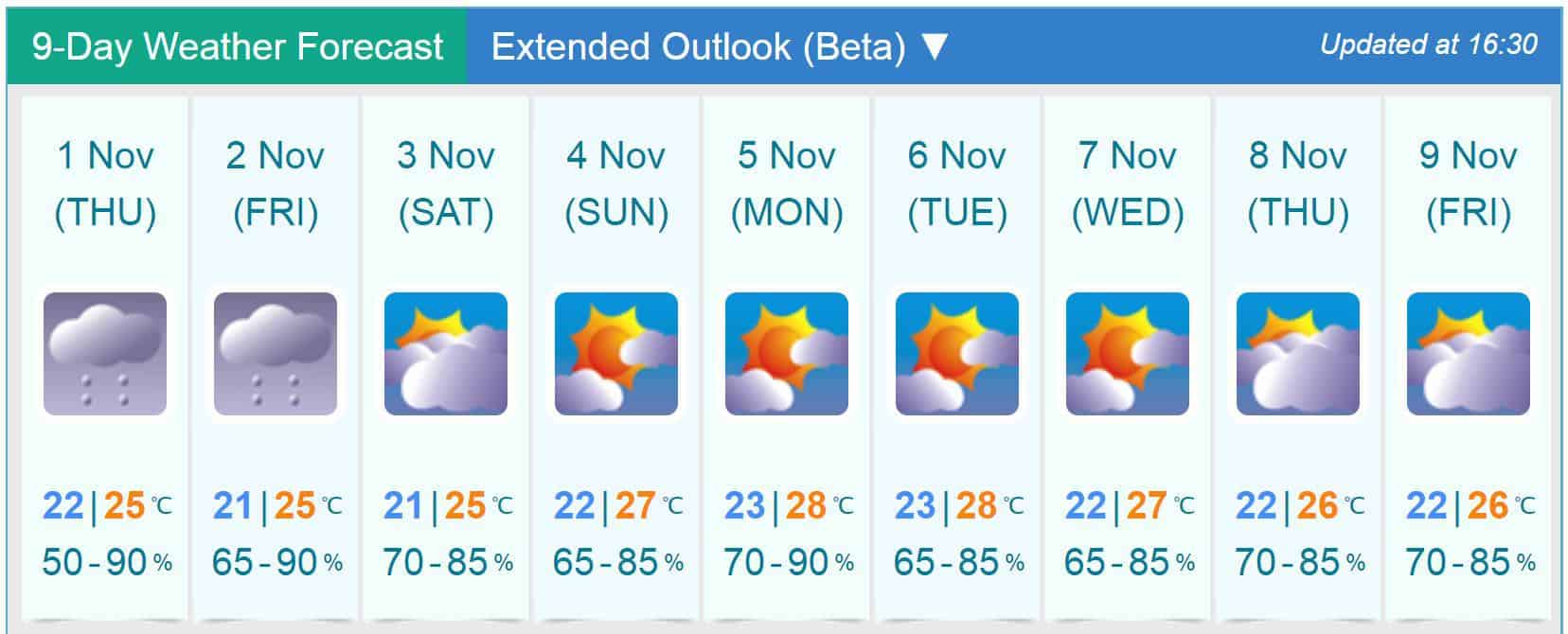
Weather Forecasts as of 9 a.m.
SZMB
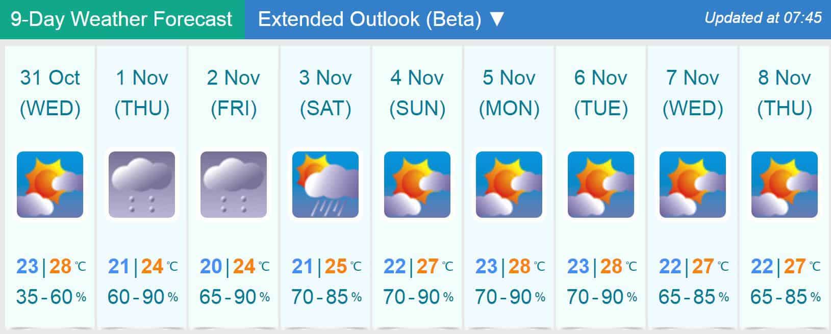
HKO
We’ll update this page with more information as it becomes available. In the meantime, you can also use the Storm Trackers and Windy APP below to keep an eye on the storm.
UPDATE from the HKO at 8:45 p.m:
With the combined effect of the northeast monsoon and Yutu, winds over the coast of Guangdong are expected to strengthen gradually on Thursday and Friday. However, the chance of generally strong winds affecting Hong Kong on Thursday morning is not high. The chance of issuing the Strong Wind Signal, No. 3 before 6 a.m. on Thursday is relatively low. Members of the public should pay attention to the latest weather warning bulletin before leaving home on Thursday morning.
As there are swells, you are advised to stay away from the shoreline and not to engage in water sports.
UPDATE: The SZMB upgraded their Typhoon Warning to Blue for the Eastern and Western parts of the city at 5:30 p.m October 31st.
The HKO issued the following accouncement at 4:30 p.m.
In the past few hours, the structure of Yutu near its centre was relatively loose. Yutu is expected to re-organize gradually and turn to the north tonight and tomorrow. According to the present forecast track, the chance of local winds becoming generally strong tonight is relatively low. The chance of issuing Strong Wind Signal, No. 3 before midnight is not high. With the combined effect of northeast monsoon and Yutu, winds over the coast of Guangdong are expected to strengthen tomorrow and on Friday.
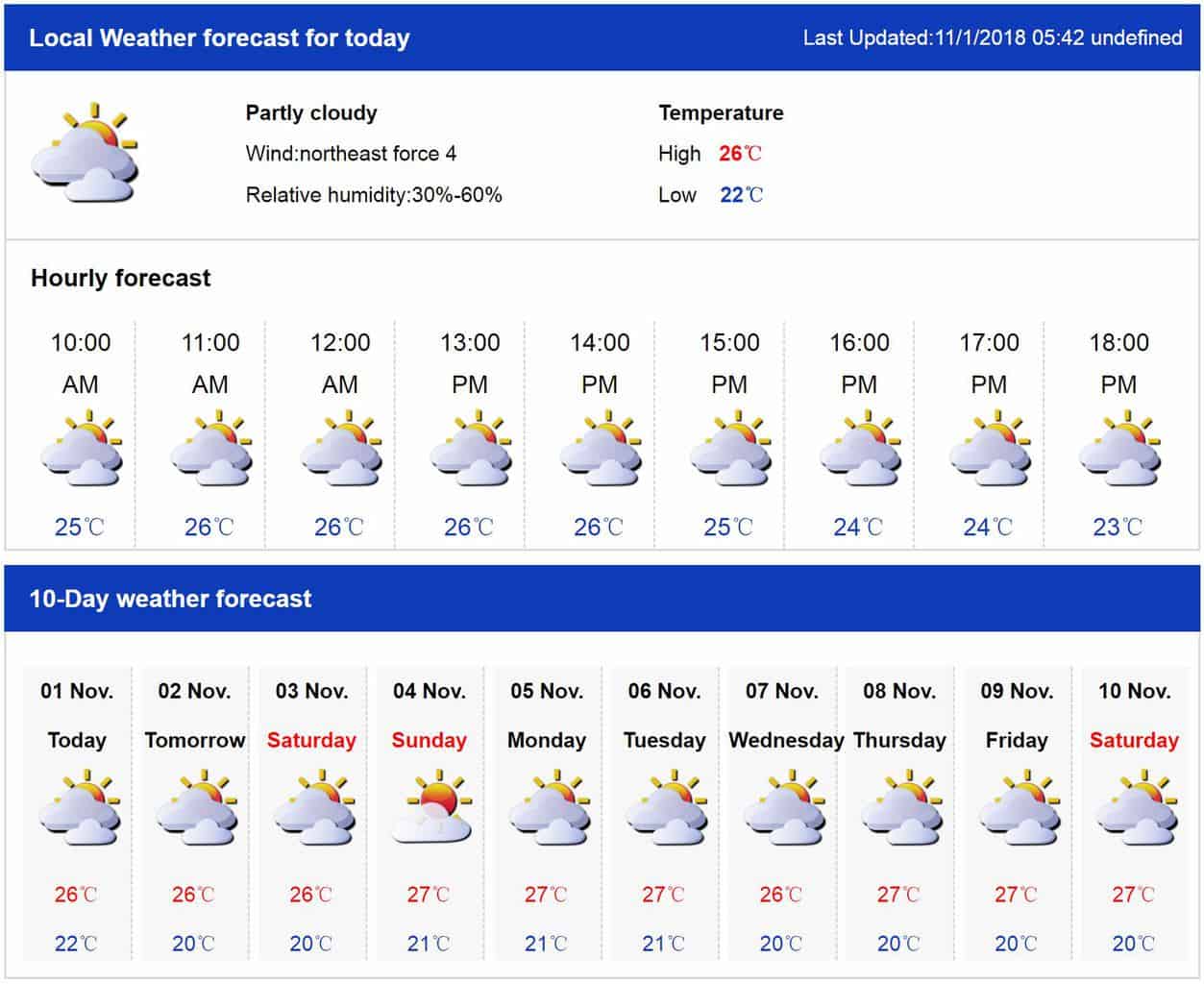
Weather Forecasts
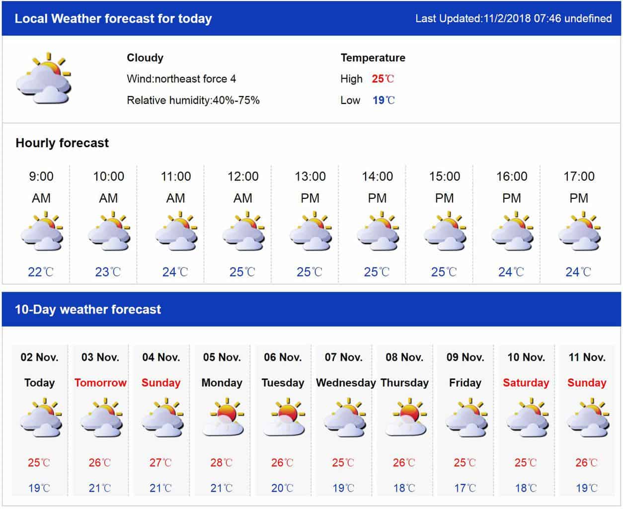
SZMB
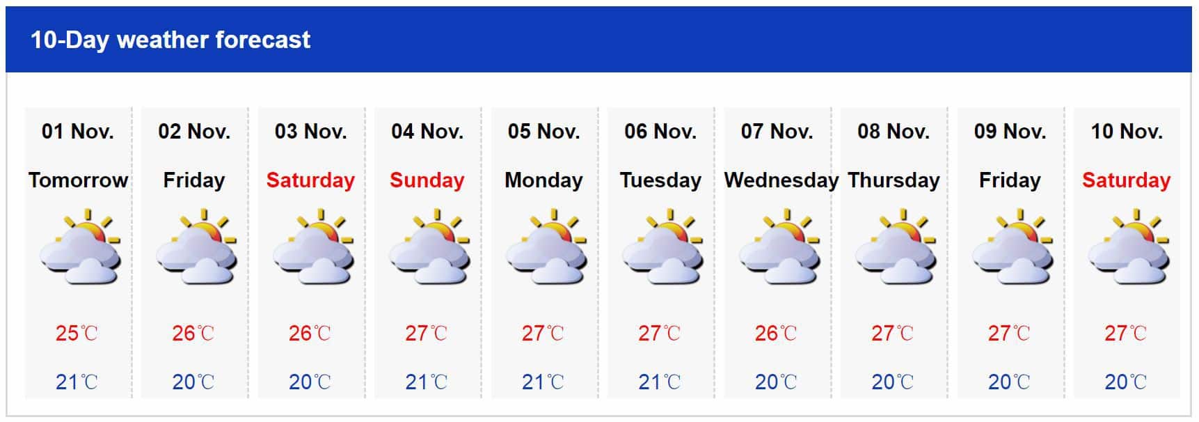
HKO
Originally Published October 31st 10:30 a.m.
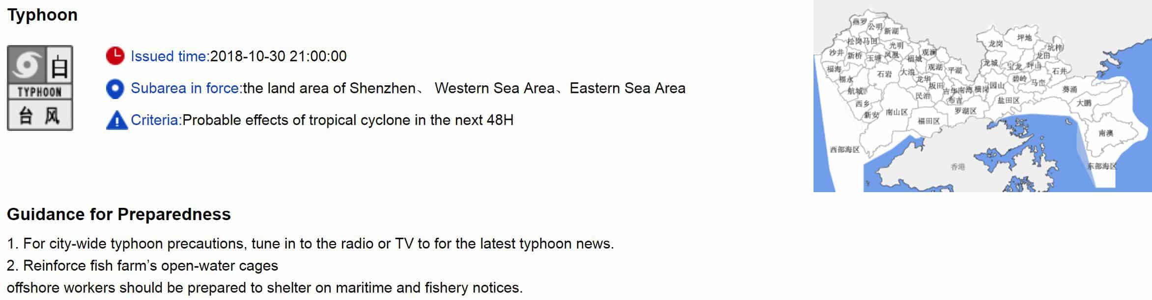
The Hong Kong Observatory (HKO) issued their Standby Signal, No. 1 this morning at 8:40 a.m after the Shenzhen Meteorological Bureau issued a city-wide White Typhoon Warning last night at 9 p.m as Typhoon Yutu entered the South China Sea.
UPDATE: 11:45 a.m HKO Accouncement:
According to the present forecast track, Yutu is forecast to gradually re-organize and turn north today and tomorrow. It will maintain a distance of over 500 kilometres away from Hong Kong most of the time today. The chance of issuing Strong Wind Signal, No. 3 during the day is not high. With the combined effect of northeast monsoon and Yutu, winds over the coast of Guangdong are expected to strengthen on Thursday and Friday.
Typhoon Yutu, known in the Philippines as Typhoon Rosita, is the most powerful tropical cyclone to impact the Mariana Islands on record. It is the twenty-sixth named storm, twelfth typhoon, and the seventh super typhoon of the 2018 Pacific typhoon season. Yutu originated in the western Pacific Ocean on October 21 and intensified to Category 5 super typhoon on October 24. On the 25th, Yutu, at it’s peak intensity, made landfall on the island of Tinian and the southern part of Saipan. With wind gusts of up to 305 km/h (190 mph), it is the most powerful tropical cyclone worldwide in 2018 to date. Yutu caused catastrophic damage across Tinian and Saipan, destroying numerous homes and killing at least 2 people. In the Philippines, widespread landslides killed at least 6 people and left more than 23 others missing.
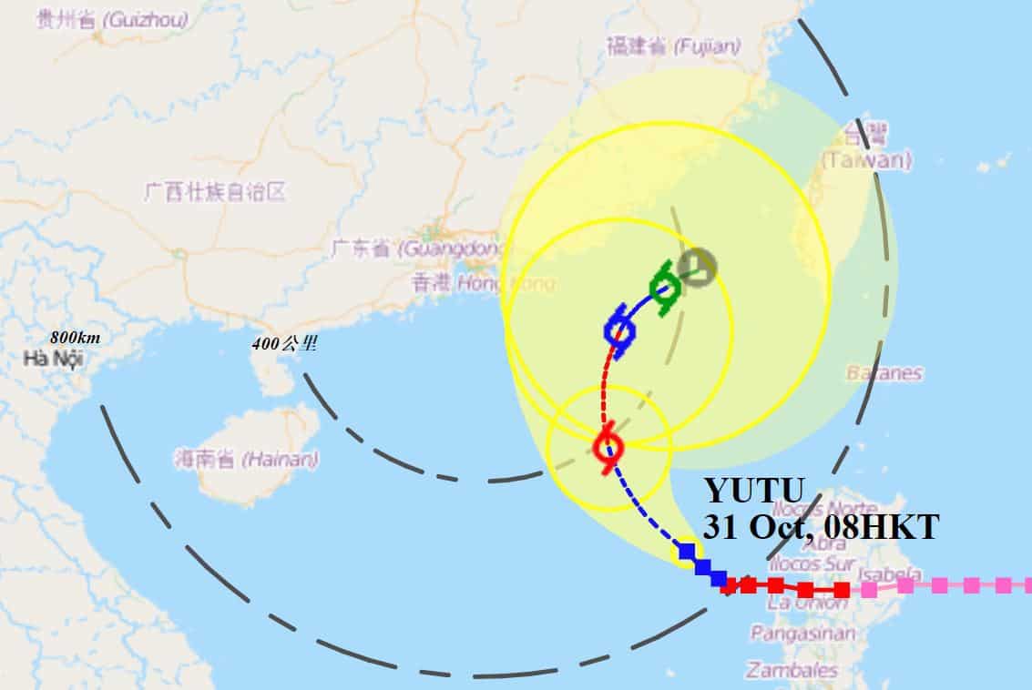
At 9 a.m this morning, the HKO estimated that now Severe Tropical Storm Yutu was about 670 kilometres southeast of Hong Kong, and was forecast to move northwest at about 12 kilometres per hour crossing the northeastern part of the South China Sea.
Yutu moved northwest and weakened slightly early this morning. Yutu is forecast to slow down and turn north today and tomorrow, crossing the northeastern part of the South China Sea. According to the present forecast track, Yutu will maintain a distance of over 500 kilometres away from Hong Kong most of the time today. The chance of issuing Strong Wind Signal, No. 3 during the day is not high. With the combined effect of northeast monsoon and Yutu, winds over the coast of Guangdong are expected to strengthen on Thursday and Friday.
HKO’s Precautionary Announcements with No. 1 Signal
1. Precautions should be taken. Windows and doors should be checked.
2. Those who have duties during a tropical cyclone should now remain on call.
3. People planning to visit Guangdong, Macau, outlying islands or remote parts of Hong Kong should note that changes in weather may affect your trips.
4. Fishing vessels and low power vessels in open sea should seek shelter as soon as possible and be secured properly with moorings.
5. Construction and property management practitioners should make sure that overhanging facilities and temporary structures outdoors are securely fastened, and should take precautionary measures.
6. Listen to radio, watch TV or browse the Hong Kong Observatory’s website and mobile app for the latest information on the tropical cyclone.
Weather Forecast
Weather forecasts as of this morning between the SZMB and the HKO vary, with the SZMB showing rain just for tomorrow while the HKO forecasts rain into the weekend.